// project · podklad

Podklad

Check a Czech property before you buy it. Type an address, get a complete desk study from public data in minutes — cadastre, 3D terrain, floods, radon, geology, noise, crime, price — explained in plain language, with a PDF for the bank.

Czech marketOpen data3D terrainLive

Note: this page is an AI-generated summary of the project. The product, the code, and the data behind it are real — the prose isn't hand-written.

// why

Buying property in Czechia means either paying thousands and waiting days for a professional check, or clicking through a dozen state portals yourself and hoping you didn't miss the flood zone. All of the data is public — cadastre, radon maps, geology, undermining, zoning, crime, prices — it's just scattered and hostile. Podklad assembles it into one visual study in minutes: a red/amber/green risk list, a 3D block of the actual terrain, and an AI that reads the findings back in human Czech. The preview is free; the full study costs 499 Kč — less than a round of drinks with the lawyer who'd tell you to check these things anyway.

// look

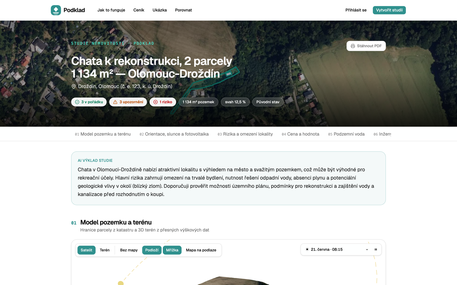
The property as a block of earth — real elevation data, satellite skin, parcel outline. Live from podklad.com/studie/chata-drozdin-olomouc.
A full property study with risk summary and AI explanation
The study: risk badges up top, AI verdict first, twelve chapters of evidence below.
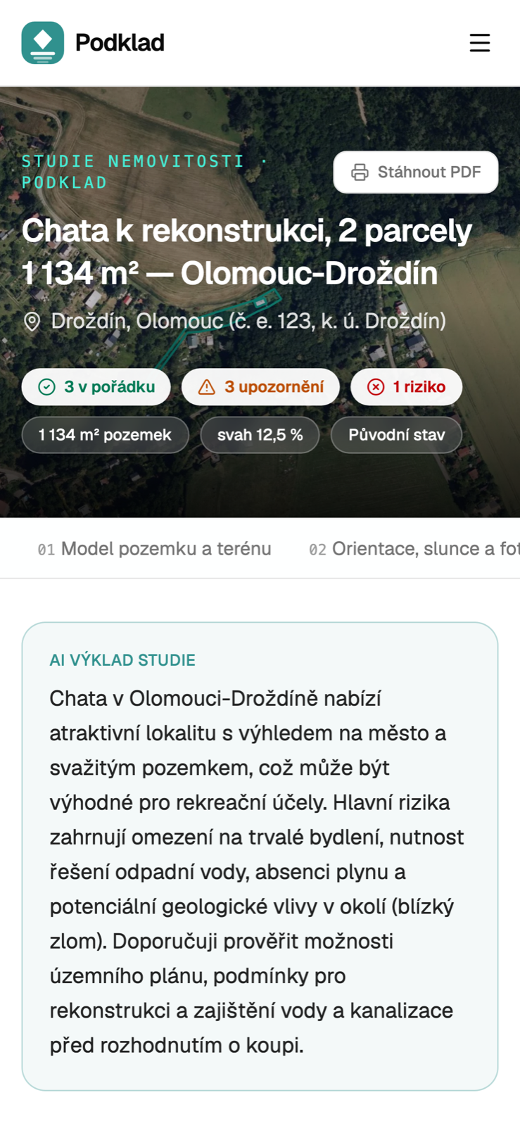
Property study on mobile
The same study, readable on a viewing.
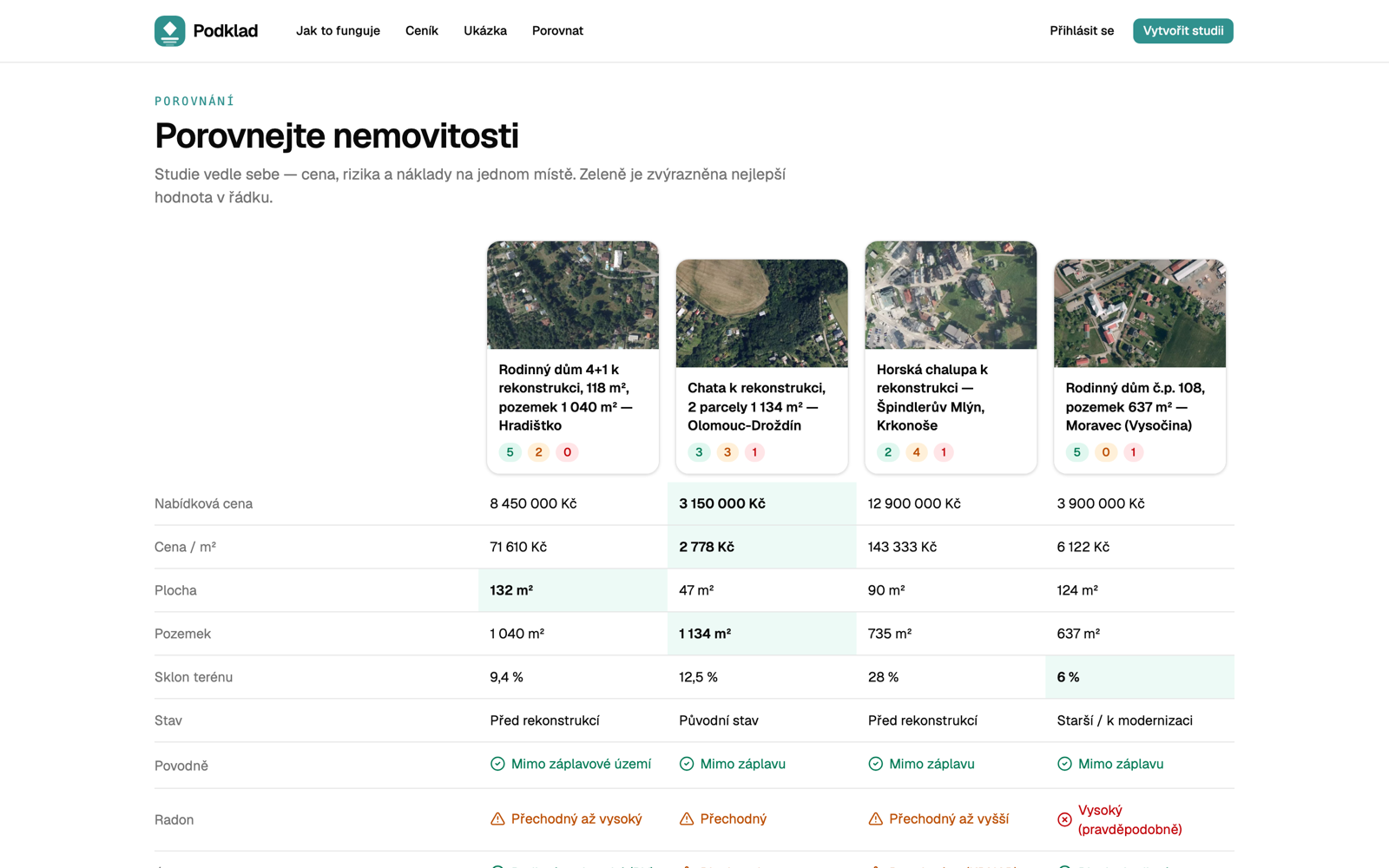
Side-by-side comparison of four property studies
Comparing four properties — price, risks, radon, floods — best value highlighted per row.

// the data bit

Every chapter of a study is backed by an official Czech source, fetched and cross-referenced per parcel. The 3D block is built from the state's DMR 5G elevation model with a satellite drape, so the slope you see is the slope you'd stand on — with the sun in the right place for the date and time.

  • ČÚZK katastr — parcels, buildings, ownership structure
  • DMR 5G — 5m-grid elevation model for the 3D terrain
  • ČGS — radon index, geology, undermining, landslides
  • VÚV TGM — flood zones (Q5/Q20/Q100)
  • Policie ČR — crime index vs national average
  • ČSÚ — price per m² vs regional average
  • Územní plány — zoning and buildability
  • Sun position — orientation and solar potential

// stack

how it's built
  • TanStack StartReact 19, file-based routes, SSR on the edge
  • Cloudflare Workers + D1The whole product runs on one Worker
  • Three.js / R3FThe 3D terrain block — DMR 5G + satellite drape
  • Mapbox GLFlood zones, noise, and context maps
  • OpenRouterThe AI that reads the study back in plain Czech
  • Stripe (REST)499 Kč unlock, no SDK, just fetch
  • ResendMagic links and study-ready emails
  • Tailwind 4 + shadcn/uiSame design system as everything else here
  • Bun + raw SQL migrationsNo ORM ceremony

// status

  • Live at podklad.com — free preview without an account, full study 499 Kč.
  • Next: owner verification through the official ČÚZK WSDP interface, as a premium add-on.
  • Czechia first by design — the moat is the plumbing into the local registries, not the UI.